STORIES
The Water Security Agency through the Agricultural Water Management Strategy has worked with many producers, landowners, stakeholders, Conservation and Development Authorities, and Watershed Authorities to implement and support responsible solutions to managing and draining some water.
This positive approach has set the stage for thousands of quarters to come into compliance.
Currently, the Water Security Agency is working with hundreds of landowners on various organized drainage projects across the province.
Belle Plaine-Drinkwater C&D Project
Belle Plaine – Drinkwater Conservation and Development Area Authority (CAA) formed in 2015. High precipitation levels over the past decade challenged agricultural landowners, communities, and other agencies with infrastructure in the area. Erosion and flooding have been major concerns for all landowners.
This C&D involves 49 landowners involved, encompassing 136 quarter sections (21,760 acres). It has created powerful opportunities for all landowners to work together towards improved water management and collective benefit for all.
At full build out, the project will involve construction of a main drainage channel and three lateral channels, which together will establish an “adequate outlet” required for future agricultural drainage activities.
The project was required to demonstrate that adequate flow control, water quality, and wildlife habitat mitigation measures were being incorporated as essential project elements.
Working together with the Moose Jaw River Watershed Stewardship Association and Stantec Consulting, the Belle Plaine – Drinkwater CAA Board designed a plan which includes: two gated control structures; the use of two wetlands to control water flows, six erosion control matting/seeding locations, and 10 erosion control/energy dissipation structures known as “double step cross vanes with plunge pools” to manage water flows at specific locations throughout the project known to be at high erosion risk.
At three key upstream locations, natural wetlands will be retained to regulate water flows and maintain important waterfowl habitat. At minimum flow volumes, a total of 48 acres of permanent wetlands will exist. At peak water flow volumes, these wetlands will expand to 635 acres in size to capture, store, and gradually release water at a rate which the project and Moose Jaw River downstream can accommodate without flooding or erosion.
At the final outlet of the project, important measures are being undertaken to sustain and improve aquatic habitat as the project reaches the Moose Jaw River. Vegetation plantings and other erosion control measures will ensure that water quality coming from the project does not degrade conditions in the Moose Jaw River.
With support from WSA, the Moose Jaw River Watershed Stewardship Association played a key role working with all partners to advance the project. The MJRWS Association will now be working with Belle Plaine – Drinkwater CAA agricultural landowners to obtain WSA approval for all drainage activities within the CAA as a “Priority Drainage Network” similar to the Dry Lake Project approved earlier this year in the RM of Montmartre.
Agricultural drainage approval by WSA will involve on-farm water flow and erosion controls designed to minimize downstream flooding, maximize water quality, and optimize wildlife habitat while facilitating productive agricultural land use.
Dry Lake Drainage Project
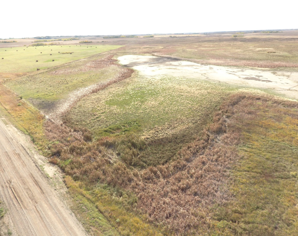
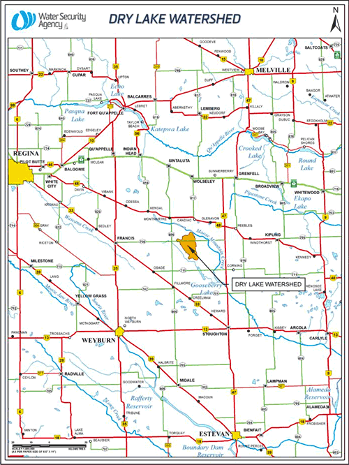
What does this project do?
- The Dry Lake Project saw the Water Security Agency take a number of new approaches to issue this historic approval. A joint application was utilized for land control replacing the previous requirement for legal easements on 113 quarter sections or hundreds of neighbour-to-neighbour land control agreements.
- By installing 30 staging culverts, controlled release will throttle spring runoff to the equivalent of a one-in-two-year flow rate.
- All flow controls for existing drainage works have already been constructed by participating landowners, ensuring that downstream landowners and communities will not experience flooding due to this project.
- The project restored 34 acres of wetland on existing drainage and 21 acres of wetland retention on new drainage, representing a very substantial contribution made by agricultural producers in support of wetland habitat conservation.
Lang West Conservation and Development Area
Farmers in the Lang West Conservation and Development Area, southeast of Regina, formed the C & D in 2012 after major flooding in 2011. The group came up with an innovative, environmentally responsible approach to channel their runoff into the Moose Jaw River.
Together with the help of the Moose Jaw River Watershed Stewards (MJRWS), the group approached the Water Security Agency with a drainage solution that was approved in March of 2018. A single approval was granted covering 30 quarters of agricultural land, lessening the risk of floods and protecting certain wetlands, while also managing wildlife habitat impacts.
“We’re proud of this project because we relied on the three C’s to get the work done,” Lang West Conservation and Development Area Authority Chair Jim Faulkner said. “First there was strong commitment from a core group of producers interested in responsible drainage, and second, good communication between all of us to ensure we understood how to best move forward. Last, there was co-operation between all of us to work with the WSA and local stakeholders to make this project happen.”
“The MJRWS was engaged by WSA and the Lang West group to act as a Qualified Person to develop the application for drainage approval,” Moose Jaw River Watershed Stewards Manager Janine Heinrichs said. “Throughout the process there were challenges, but together with WSA regional staff and Lang West group, we worked to find a sound solution to ensure this project would succeed and mitigate risks to the area.”
“These record numbers show hundreds of landowners are now working together to create responsible drainage networks that respect individual properties and ensure the safe management of our water resources,” Minister Responsible for Saskatchewan Water Security Agency Dustin Duncan said. “It will create lasting benefits for Saskatchewan producers, our downstream neighbours, and future generations.”
This positive approach has set the stage for thousands of quarters to come into compliance.
Currently, the Water Security Agency is working with hundreds of landowners on 12 organized drainage projects making up more than 160,000 acres.
Atwater Project
The Water Security Agency (WSA) issued a large scale 12,000 acre drainage approval near Atwater to 33 landowners, bringing the properties together in an organized and sustainably-managed drainage network.
It is a large area of interconnected drainage works with a common outlet, Kapsovar Creek, and involved 41 landowners, the Village of Atwater, Canadian National Railway, and the RM of Fertile Belt.
While there is already mitigation works in place, landowners are using erosion control measures to protect water quality into the Kaposvar Creek and Qu’Appelle River and 81 flow control structures (such as gated culverts, throttle culverts and weirs) to reduce downstream flooding impacts.
The Lower Qu’Appelle Watershed Stewards provided Qualified Persons support, which was critical to the landowners successfully navigating the approvals process.
The Atwater project demonstrates the strength of a network approach. Neighbours worked together to coordinate drainage and protect important drainage works, while taking steps to reduce and manage downstream impacts.